

Thursday, July 01, 2004
June Weather Recap
Josh Larson @ 10:06 AM
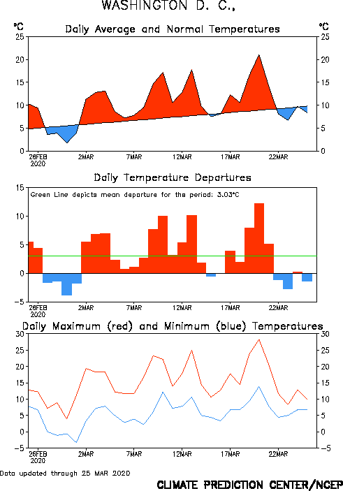
June weather in the DC area was surprisingly close to "normal." Temperatures were either at normal levels or a degree or two below normal at all three local airports. Reagan National (DCA) recorded an average high/low temperature of 81/65, which is 1.5° below normal. Dulles (IAD) recorded an average high/low temperature of 81/61, which is normal. And Baltimore Washington (BWI) recorded an average high/low of 81/61, which is 1° below normal.
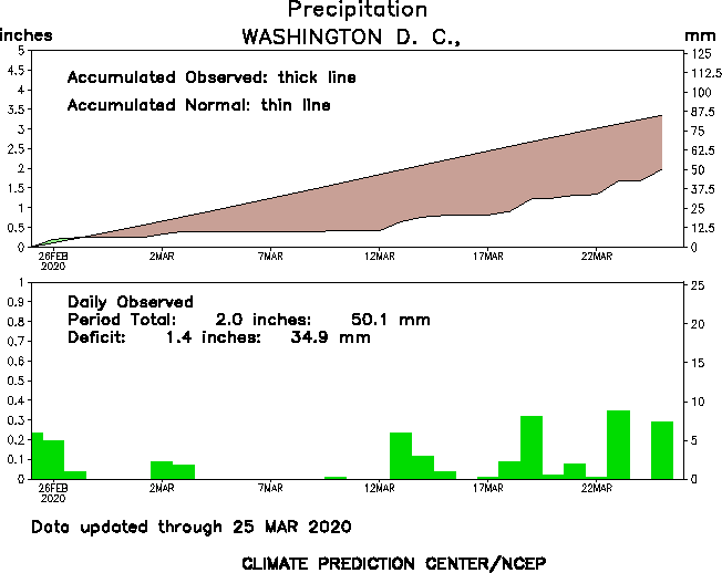
In a testament to the fact that June thunderstorms in DC are frequently of the hit-and-miss variety and do not bring rain equally to all locations in the region, DCA recorded 4.67" of rain, which is 1.47" more than, or nearly 150% of, normal; IAD recorded nearly an inch less - 3.73" - which is .34" less than, or 92% of, normal; BWI recorded 4.17" of rain, which is .74" more than, or 122% of, normal. DCA and IAD both reported measurable rain on 11 of 30 days, while BWI reported measurable rain on 14 of 30 days.
NOAA's Climate Prediction Center monitors temperatures and precipitation anomalies and presents them in an interesting format that allows one to see during which parts of the month temperature/precipitation varied from normal. Check out DCA's Temperatures or DCA's Precipitation.
Now that it is July, what is the outlook for the next week to ten days? Several models are hinting that the Eastern trough aloft, which has kept temperatures at near to slightly below-average levels during the second half of June, will break down. In place, it appears that a ridge may establish itself east of the Rockies. My belief is that for the first week to ten days of July, temperatures will average near to slightly-above normal levels.
Comments are closed for this archived entry | Link |  Email this post
Email this post
