

Wednesday, June 07, 2006
10-Day Outlook: Drought Concerns Return
Josh Larson @ 11:00 PM
Today's Weather
The rest of the forecast, through the weekend and beyond, continues below after the Pattern Overview.
Pattern Overview
Jason made an accurate, and prescient, prediction on Monday in suggesting that the rain threats this week would likely have "more bark than bite." Indeed, for most of the immediate DC metro area, little, if any, measurable rain has fallen over the past few days. In fact, only a paltry .16" of rain has fallen at DCA over the past 18 days!
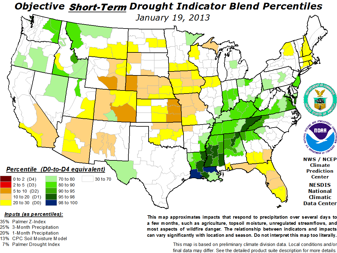 It is beginning to look as though we may be well on our way towards experiencing seriously dry conditions: the groundwork for actual drought conditions has been laid by the past 3 weeks' lack of moisture. Indeed, the HPC's 5-day rainfall forecast suggests that less than .25" of precipitation might fall over the next five days -- and even that forecast may be optimistic. In addition, the GFS forecast model brings well under a half-inch of rain to the area over the entire next week!
While the current US Drought Monitor still has DC in the "abnormally dry category" one can see how close (to our southwest) "moderate drought conditions" lurk. Indeed, CPC's Objective Short-Term Drought Indicator -- seen above -- suggests that moderate drought conditions may be imminent for much of the region, with the potential for severe drought conditions for areas to our southwest.
The next 5 days (June 8-12)
Forecast highs/lows: 79/61 (normal = 83/64)
Forecast precip: Much below normal
The following 5 days (June 13-17)
Forecast highs/lows: 83/64 (normal = 84/65)
Forecast precip: Below normal
The forecast looks quite innocuous, with mostly sunny skies Tuesday through Friday of next week, moderate humidity levels, and highs mostly from 80-85 (with overnight lows mostly in the mid 60s). While widely scattered pop-up thunderstorms may develop during one or more of these days, widespread, drought-busting, precipitation may be tough to come by until the next cold front.
Bonus Tropical Tidbit
Some models (namely the NAM and Canadian) have been hinting at the potential for the season's first Atlantic tropical system to form over the next 5 days in the southern Bay of Campeche. Other models, however, suggest that there may be too much wind shear present over this region to support tropical cyclone development. I guess we'll have to wait and see...
Comments are closed for this archived entry | Link |  Email this post
Email this post
