

Wednesday, June 07, 2006
New England Deluge, Mid-Atlantic Delight
Jason Samenow @ 4:00 PM
post by Steve Scolnik
While an unusual June nor'easter slams southern New England with heavy rain, chilly temperatures, and strong winds, the DC area enjoys a pleasant evening.
Tonight and Tomorrow
For the outlook through the weekend, scroll on down to Dan's post below.
Previously
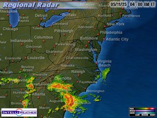
 Hyannis, Massachusetts, on Cape Cod, had over 4.5" of rain as of early this afternoon, temperatures in the 50s, and winds gusting as high as 35 mph. Meanwhile, the air flowing outward and descending from this storm has kept the Washington DC metro area sunny and dry. Regional radar showed rain showers extending only as far as extreme northeastern Maryland, and clouds were mainly northeast of Baltimore. As a result, temperature forecasts from yesterday for the area were busted; many locations, including the two major airports, reached 84° by 4pm. BWI, with a heavier cloud cover, was at 82°, having earlier been a degree higher.
Moving ahead
The low pressure area now southeast of New England will drift slowly eastward as it spins down over the next 36 hours. Meanwhile, another area of showers will move southeastward from the Ohio Valley to southeastern Virgina/northeastern North Carolina by tomorrow evening, bringing the possibility of showers, mainly to the south of the Beltway.
Radar map at about 3:45pm today from IntelliWeather
Comments are closed for this archived entry | Link |  Email this post
Email this post
